Kleingers at the 2017 International Trail Symposium
The Kleingers Group recently spoke at the 2017 International Trail Symposium held in Dayton, Ohio. The educational conference brings together experts from all across the globe to learn more about trail system challenges, successes, and progressive ideas. We were inspired by so many ideas and conversations shared during the conference that we thought we would share some of our thoughts with you.
See our takeaways from speaking/attending below:
Sharing International Challenges and Successes
- Those in attendance during our speaking session included individuals from Brazil, El Salvador, Idaho, and New England (just to name a few). It was incredible to sit alongside others from all across the globe, discussing similar challenges, programs, and worldwide support for creating trails to connect people across the earth.
- Much like what we see in areas where we perform trail engineering and design services, many cities across the globe have been built around a single mode of transportation – cars.
- In general, Ohio has created many fantastic ‘destination trails’ where families travel by car, with bikes in tow, for recreation. Recreational communities across the state have done a great job creating these core recreation destinations. The challenge now is to create paths that connect these destinations with the people of the area.
Dayton Sets an Example for Others Across the Globe
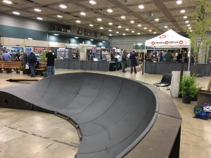
More than just trails and paths, extreme biking paths were demonstrated at the symposium.
- Dayton has such a rich history of those within the biking community. The Wright brothers and the founder of Huffy Bicycles both got their starts in the area.
- Dayton is home to the largest paved trail network in the United States.
- Following the Great Miami River flood of 1913, the Miami Conservancy District was both created and funded locally. The organization set out to build levees in the area and eventually turned its attention to focus on water activity and then trails.
- Many organizations across the country look to the conservancy as a leading example. The district has found ways to continue funding the program which helps maintain the trails in the area, including winter plowing, ADA upgrades, and more – typically a challenge for trail owners.
- The Dayton area is also known in the trail community for Huffy’s ‘Rails to Trails’ conservancy program developed in the 1970s, before converting old rail lines to bike trails was popular.
- Large metropolitan stakeholders across the globe are just now getting programs in place and look to the Dayton area as a leading example.
Changing our approach to trails through progressive examples for funding area complete streets.
- Historically, money is spent ordinarily on the right-of-way for roadways. Complete streets is a way of approaching how best to a projects’ right-of-way while generating modes of transportation and access for all-wheel riders (aside from cars).
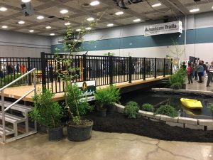
Prefabricated bridge showcased in the exhibit space.
How is The Kleingers Group affecting change in the area?
- As one example, Kleingers currently serves as the City of Wilmington, Ohio’s municipal engineer. We have been working with the city to set in place an active transportation plan which focuses on multi-modal transportation with complete street elements so that when new projects are completed within the city, they will comply with the program. The results will be a community that is not only multi-modal but a desirable place to live, work and play.
- Kleingers was recently awarded a fourth task order with ODOT for Safe Routes to Schools and Pedestrian Safety. We have an ongoing commitment to design multi-modal paths for school districts and local governments while creating a safe and healthy means of travel for students and families all across the State of Ohio.
Successful trails not only encourage healthy living and help reduce the carbon footprint; studies have shown they also increase property values for those adjacent to and in close proximity to the path. If we can consider the above successes, challenges, and creative approaches to constructing paths and trails for recreation and commuters alike, then we can (alongside others across the globe) create more desirable places to live and enjoy.
6 Questions to Ask Before Beginning Your Next Bridge Project
No two bridge projects are ever alike. Even a small bridge can present unforeseen obstacles that can create added costs. But by answering a few questions at the beginning of a bridge project, you can help ensure the project gets off to the best possible start, ultimately preventing delays, boosting public satisfaction, and increasing the lifespan of the bridge.
- Do We Really Need Soil Information?
The answer is “yes” if you want the most economical design and a design that is most compatible with the actual soil conditions at the site. Many people may think they are saving money by skipping a geotechnical investigation, but it forces the structural engineers to guess about the load capacity of the soils and other soil properties that are central to the design. Without a geotechnical investigation, the structural engineer is forced to be conservative in the design, likely driving up the cost of the bridge. The added costs due to a conservative design are likely to be more than the cost of the geotechnical investigation.
- Does Traffic Need to Be Maintained Throughout the Project?
Before beginning a project, municipal or county officials will need to decide how important it is to maintain traffic during construction. While maintaining traffic is often more costly and can lengthen construction time, depending on the route, a detour may cause undue inconvenience to the public.
- Will the Roadway and Stream Alignment Cause Any Special Design Considerations?
The alignment of the roadway will likely play a big part in what type of bridge is best suited to the site. For instance, if a medium-span bridge is needed and it is on a horizontal curve, a cast-in-place concrete slab will likely be the best deck type because of the ability to form the edges of the deck. Stream alignment relative to the bridge foundations should be closely evaluated because it can have a major effect on scour potential. Poor stream alignment causes scour to occur more easily, adding maintenance costs and likely reducing the lifespan of the bridge.
- Is the Project in A FEMA Special Flood Hazard Zone?
If a bridge is in a flood zone, there are special design considerations. For instance, a bridge that crosses a stream in a flood zone has to be high enough and long enough to avoid causing an increase in the flood elevation. This often results in a bridge that is larger than what would otherwise be required for non-flood zone stream crossings. Coordination with the local floodplain administrator is also required when the site is in a flood zone.
- Where Are the Utilities?
Design should not begin without accurately identifying the precise location of utilities and including that information in the survey of existing conditions. Accidentally hitting a utility during construction is extremely dangerous and will cause costly delays. The design of the bridge should be such that as few utilities as possible will have to be moved to accommodate the construction.
- Will Environmental Permits Be Needed? What About an Environmental Assessment?
The design of the bridge can drive whether an individual permit (a long, drawn-out process) is needed, or if the design can qualify under a nationwide permit. But other issues, such as if there are wetlands in the area, will also affect the permitting process. Nearly every bridge project should begin with an environmental review to identify those potential issues.
Ultimately the right project manager can help you make choices that are both cost-effective and will have a positive long-term impact on your community.
At the Kleingers Group, our team of structural engineers and bridge inspectors are focused on innovative ideas to build and restore bridges, cost-effectively and quickly. Our licensed structural engineers work closely with our transportation engineers to ensure coordination is seamless and meets your project’s needs.
Contact Mike Brunner at mike.brunner@kleingers.com to learn more about how Kleingers can help with your next bridge project.
4 Ways the Kleingers Group Will Make Your Next Traffic Count Better
The Kleingers Group recently acquired unmanned bird’s eye perspective video capture devices, a new way to conduct traffic counts. Rather than requiring a person to stand at an intersection, the new technology converts images to data using video collected through a battery-operated camera.
The benefits to you are:
- Access to Multiple Days of Data at No Extra Cost: A traditional intersection traffic count only collects one day of data. Sometimes something unexpected happens, such as a crash on a nearby street that diverts traffic and creates a high count. With video capture devices, The Kleingers Group has access to several days of data to ensure the traffic count is giving a representative picture.
- Counts at Abnormal Locations (such as Roundabouts) at A Reduced Cost: Busy roundabouts are notoriously hard to count because the person counting has to follow the car along its entire path through the roundabout. Often roundabouts require multiple people to conduct a count, raising costs. With video capture, costs don’t increase.
- More Information than Just Numbers: Sometimes traffic patterns need to be observed to get the full picture. An intersection may be too busy for a person to count the traffic and simultaneously make notes of needed observations. Now, video can be reviewed directly, allowing the engineer to make the necessary observations, often at a sped-up rate. The end result is more information to help you make smart decisions.
- The Ability to Review Data at A Later Time: Sometimes specific questions about existing conditions don’t arise until after the traffic count is finished. With video capture, The Kleingers Group can go back and review the video on file to answer new questions, saving a repeat field visit.
Read how The Kleingers Group is using new technology to create an innovative parking solution on Blue Ash Road or contact The Kleingers Group to discuss how we can use video capture and smart analysis to help solve your traffic or parking problem.
What’s the Back-Up Plan? Changing the Parking Scheme on Blue Ash Road
Backing out of 90-degree on-street parking into a busy road is generally recognized as a very dangerous parking maneuver. Drivers often can’t get a good view of oncoming traffic before pulling into it, leading to driver anxiety and accidents.
So when The Kleingers Group started a safety improvement study for Blue Ash Road in the City of Deer Park, the existing 90-degree on-street parking was a major concern.
The transportation and infrastructure group used Miovision Scout Data Collectors—a camera that records video for use in data collection and observation—to observe parking maneuvers along the corridor. With video capture, they were able to cost-effectively perform over a day’s worth of observations at a birds-eye view.
What they found was surprising: a good portion of drivers were already backing into the existing 90-degree parking spaces to enable themselves to be able to see when they pulled out later.
This knowledge led The Kleingers Group to consider reverse angle parking, an innovative solution.
Unlike traditional angled parking, in which drivers pull into a space head-on, reverse angle parking encourages drivers to drive just past an open space and back in, vastly improving visibility when they pull out. The result is parking that is safer for both drivers, cyclists, and pedestrians.
Although reverse-angle parking is less common than traditional angled parking, the data from video observation showed that a culture of backing into on-street parking already existed.
“We learned that a good portion of drivers were already making maneuvers similar to the changes we were proposing,” Traffic Engineer Dave Meyer said. “Reverse angle parking will allow much greater visibility when you are exiting a parking spot.”
Although education campaigns will still be necessary to acquaint residents with the alternative parking scheme, many drivers won’t have to substantially change their habits. By encouraging the remaining drivers to also back into their parking space, accidents should be reduced and parking will be safer for motorists, cyclists, and pedestrians.
The result is increased economic development—including visitors, shoppers, and diners—as people feel safer parking and, as a result, frequenting the area.
Improvements to Blue Ash Road are expected to be completed in 2019.